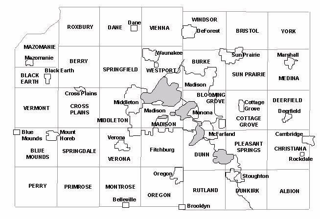
The following maps compare civil townships with Congressional Townships in Dane County Wisconsin.
Congressional townships in Dane County, Wisconsin, 1995.
Civil townships in Dane County, Wisconsin, 1995.
CAPITAL LETTERS indicate civil townships; lower case letters indicate incorporated municipalities. Unincorporated municipalities are not shown.When Dane County was originally surveyed in the 1800s, all townships were 6 miles square (except for the northwest corner which was cut off by the Wisconsin River). With remarkably few exceptions, the boundaries of today's civil townships follow the boundaries of the original Congressional townships. The main exceptions are:
- T6N-R9E, originally the Town of Fitchburg, is now the City of Fitchburg. Even though the northern edge is jagged (due to annexations by the City of Madison back in the days when Fitchburg was a township), the general shape of the city still reflects the shape of the Congressional township from which it grew.
- The north half of T8N-R6E became part of the Town of Mazomanie, rather than the Town of Black Earth; consequently, the Town of Black Earth has only 18 sections.
- Most of the Town of Madison has disappeared. There wasn't much of it to begin with (because of the three lakes); subsequent annexations by the Cities of Madison and Middleton have removed even more land. The Town of Madison now consists of a few isolated islands, the largest along its southern boundary.
- The piece of T7N-R9E north of Lake Mendota, once part of the Town of Madison, is now part of the Town of Westport.
